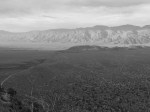
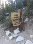
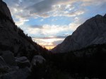
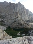
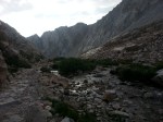
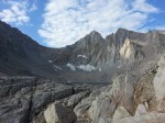
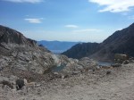
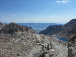
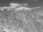
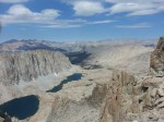
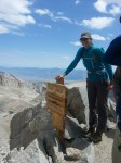
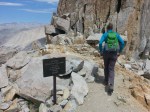
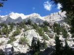
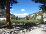
After visiting the lowest elevation in the United States and the location of the hottest verified temperature on Earth we decided to drive just over 100 miles west to the highest elevation in the contiguous US. The plan was to sleep in Lone Pine around 3700 feet above sea level, wake up at 300 am, drive up to the Whitney Portal at 8360 feet, hike the 11 miles up to Mt. Whitney Peak at 14,505 feet, and then head 11 miles back down to the car to drive back to Lone Pine for a nice shower and dinner. Unfortunately this plan failed to include time to acclimate to elevation and one of us was unable to make it above 13,700 feet. We could not camp at higher elevations as we would have liked since we were only able to get a one day permit. After trying to secure permits for many of our adventures in California we felt lucky to eventually get this one day permit. In total we made it 18.5 miles. This took us up to the ridge trail and on the way to the peak before realizing it was too uncomfortable for one of us to continue. The discomfort outweighed the potential reward and we made the decision to turn around. Making it this far allowed us to see the many of the highlights along this impressive hike. We got to enjoy pristine high elevation meadows, ice melt fed streams and lakes, sunrise over the ridge, expansive views of the severely steep and rocky sierras. The hike was long, hard, tiring, and rewarding. Unfortunately as much fun as the hike was we did not make it… Next time we will camp on the mountain at elevation in order to better acclimate and officially summit.
18.5 miles and 5200 feet change in elevation in almost 15 hours, next visit will include all 22 miles in 14 hours, just wait for it….

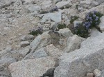
30 of the 1500 pictures! Mt. Whitney is highly photogenic.